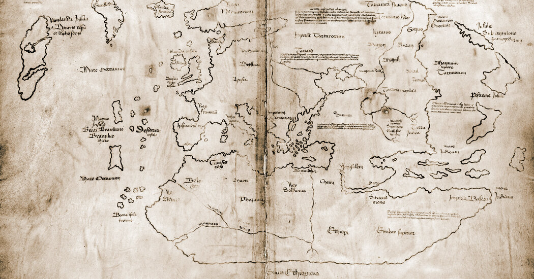
In 1965, Yale revealed the map to the public, with stories appearing in major newspapers, including on the front page of The New York Times. At the time, the school’s experts believed the map was compiled around 1440, about 50 years before Christopher Columbus sailed west.
Archaeologists and scholars have no doubt that a small number of Norse people reached the area of Newfoundland and the Gulf of St. Lawrence around A.D. 1000, with evidence both in 13th-century sagas about the journeys and the archaeological remains of a Viking settlement at a site called L’Anse aux Meadows, in Newfoundland.
There were probably fewer than 100 people on the largest of those voyages, and the travelers landed on shores where Native people lived in large numbers, said Gisli Sigurdsson, a professor of Norse studies at the Arni Magnusson Institute in Iceland.
“The stories, told and retold through generations, remember the general lay of the land: There are lands beyond Greenland, but they are really beyond our reach, too far away and too dangerous to visit,” Mr. Sigurdsson said. He added that the Vikings did, however, “continue bragging about how great and glorious an adventure it was.”
When the Vinland Map appeared in 1965, not long after the Newfoundland discovery caused a sensation, scholars quickly raised doubts about the parchment. While the curator of maps at Yale’s library at the time saw the “amazingly accurate” drawing of Greenland as evidence of Viking exploration, others saw it as the mark of an artist looking at a 20th-century map.
Greenland’s northern coast was drawn “suspiciously similar to what you can see on modern maps,” Mr. Sigurdsson said. “Greenland is so close to the real Greenland, it’s hard to believe anyone in the Middle Ages would have drawn a map like that.”
It also seemed unlikely for a medieval scribe to know that Greenland — drawn for centuries as a peninsula — was an island. “Information about the geography of the western Atlantic would have taken the form of lore and advice passed on orally from sailor to sailor,” Dr. Rowe said. “They did not use maps for navigation.”


